The relief map above is of Kluane (pr. kloo-WAH-nee), showing the inaccessible ice fields that comprise most of the park. On the close-up, I've marked the approximate site of our hike. We began just off the main road.
I signed us up for the Kluane Rock Glacier hike because of two words: 'glacier' and 'short'. Little did I know that the emphasis should have been on 'rock' with the words 'crumbly' and 'steep' added to the description. Evidently, other people did know about those attributes of an otherwise innocuous-sounding hike in Kluane National Park. We were the only two people on the hike.
 |
| The hike started out gently enough, as we moved through a stand of alders, bear berries, and fireweed. |
 |
| Bear berries. Bears love these and if you find yourself surrounded by them, keep a sharp eye out for bears. |
|
But quite soon, the terrain began to change. . . .
 |
| The beginning of Rock Glacier, edged by a stand of fireweed. Fireweed gets its name, not from its color, but from the fact that it's the first flowering plant to grow back after a forest fire. |
The trail quickly became nothing but loose, sharp rock. I'd probably have settled for climbing just to the first level, where lots of folks stop and opt to use the rest of their time building inukshuit.
 |
| This figure with arms and a head is not actually an inukshuk. The traditional inukshuk is a formation of rocks, but not a depiction of a person. In the Inuit language, the figure above would be called 'inunguak' (sp?), which means a depiction of a person. |
 |
| The traditional inukshuk would look more like this. |
Although British Columbia has adopted the inukshuk as one of its provincial icons, inukshuit are found throughout the Arctic Circle. Polar tribes built them as a way of saying "I was here". They serve as guideposts and a sort of reassurance to other nomads of ice-covered lands that they are not alone. For more background, check out this
interesting video.
As I say, I probably would have opted to pause about halfway up, perhaps build my own inukshuk, and then head back down. But since there were only two of us, we were able to take our time and pick our way all the way to the top.
 |
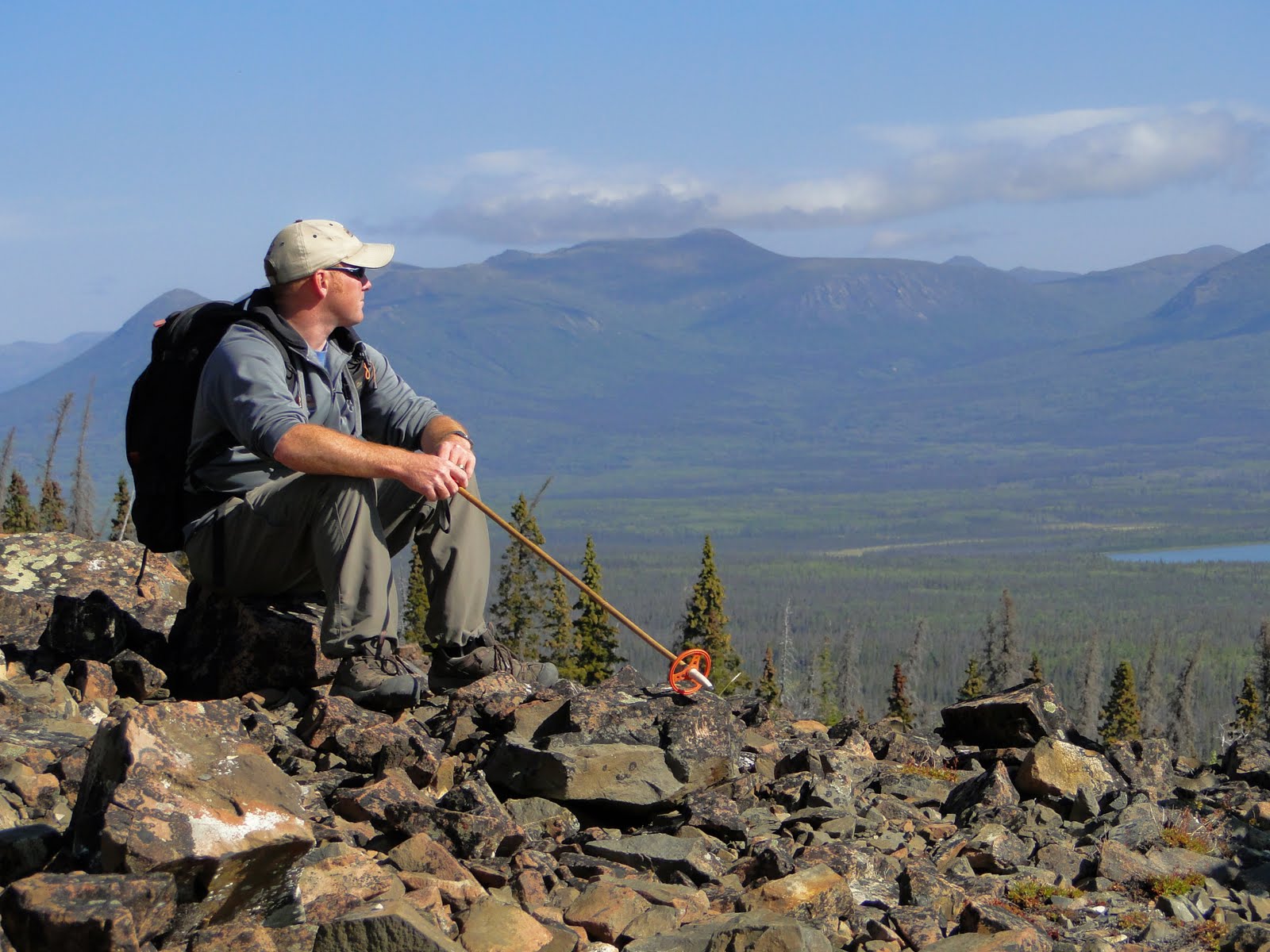
| Our guide, looking out over the Lake Dezadeash (DEZ-dee-ash) valley. |
 |
| This is as close as I could get with my 20x zoom. To my unaided eye, this hawk was a too-large blob on top of a white spruce. |
After the climb, and slowly picking our way down (note the climbing pole our guide is holding), we drove over to Lake Kathleen for lunch. Gorgeous day, all around!
Next installment: On the Road to Dawson.


No comments:
Post a Comment